Hiking Trails for Nature Lovers
- kimberlyknebel
- Nov 25, 2025
- 4 min read
Updated: Dec 26, 2025
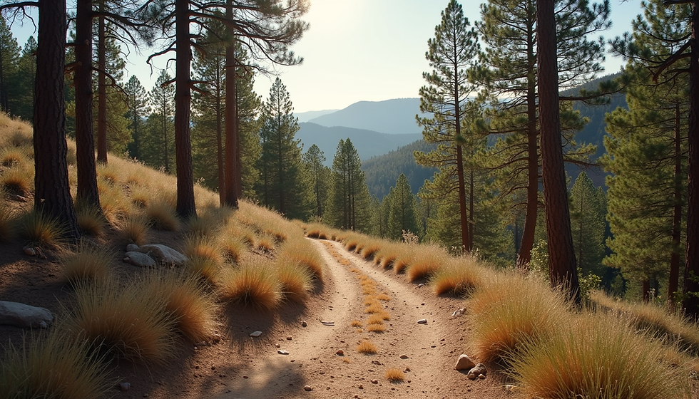
Hiking is one of the best ways to connect with nature, enjoy fresh air, and get some exercise. Whether you're looking for stunning views, serene forests, rolling hills, or gentle paths, there are plenty of hiking trails that cater to nature lovers. In this post, we will explore five hiking trails that offer breathtaking scenery and a chance to immerse yourself in the great outdoors of Arizona. These will be updated periodically as we hike more trails in Arizona, so be sure to check back often and join our mailing lists.

1. Devils Bridge - Sedona, AZ
The Devils Bridge is famous for being the longest natural sandstone arch in Sedona. It is comprised of sandy trails, steep rocky areas, and rock scrambling at the end. Expect crowds and wait to walk the arch line for the perfect photo op.
Trail Details:
Distance: Varies by trailhead, 4 miles round trip from Mescal
Difficulty: Moderate
Highlights:
- Stunning views across the Red Rock-Secret Mountain Wilderness
- Iconic views of the red rock formations, including Mescal Mountain and Courthouse Butte
- Opportunities to spot wildlife include various bird species, deer, and desert reptiles.
This trail offers a rewarding experience with its picturesque landscape. It is a perfect escape from the hustle and bustle of daily life and a chance to get out and experience nature.
2. Tom's Thumb - Scottsdale, AZ
Tom's Thumb is a striking granite rock formation and a popular strenuous hiking trail in the McDowell Sonoran Preserve in Scottsdale, Arizona. This hike is known for its significant elevation gain and beautiful desert flora like cacti, making it a challenging but rewarding adventure with stunning vistas.
Distance: 4.5 miles round trip
Difficulty: Strenuous with elevation gain of 1200 ft
Highlights:
- Granite formations and desert wildflowers
- Views of the Phoenix metro area
- Opportunities to see wildlife
This 140 ft. granite monolith resembles a giant "thumbs up" pointing toward the sky and is named after Tom Kreuser, a member of the Arizona Mountaineering Club who made the first recorded ascent of the formation in 1948.
3. Fremont Saddle via Peralta Canyon Trail - Gold Canyon, AZ
This is one of the most popular trails in the Superstition Wilderness. It features an incredible view of Weavers Needle from the saddle.
Trail Details:
Distance: 4.6 Miles out and back
Difficulty: Moderate
Highlights:
- Stunning views of Weavers Needle
- Dramatic desert landscape
- Immense geological beauty and rewarding vistas
This trail is best hike in cooler months October - April due to extreme summer heat. It has significant elevation gain towards the end of the trail. Several other trails can be accessed from Peralta Canyon Trail so after the first couple of miles look for other trail access points. It is part of a complex network throughout the Superstition Mountains.
4. Mormon Loop and National Trail - Phoenix, AZ
This hike is formed by two trails with expansive views of the valley below. Just before the half mile marker there is a six seater rock bench complete with foot stool for your enjoyment.
Trail Details:
Distance: 4.9 miles round trip
Difficulty: Moderate
Highlights:
- Great views of White Tank Mountains, Squaw Peak, Camelback Mountain, the Papago Peaks, Four Peaks, and Bank One Ballpark
- Opportunities to see diverse plant and animal life
The Mormon Trail is a great opportunity to see the Mountains and Peaks surrounding the valley. This trail is popular with mountain bikers on the trail so be careful when you hear them approaching. A cool rock formation called Fat Man's Pass is about half a mile down the Hidden Valley Trail at the National Loop junction. There are no signs directing you there so your map skills will come in handy.
5. Skyline Regional Park - Buckeye,AZ
Skyline Regional Park offers miles of trails within the 8,700 acre mountain preserve. So if you are looking for a short hikes you can find it here. All trails vary in length and interconnect so you can take different routes with each visit. There are 21 trails in the park to make you hiking experience unique.
Trail Details:
Distance: 0.5 -3 miles each trail
Difficulty: Easy -Difficult
Highlights:
- Elevation gains range from 45 - 3,366 feet on the 21 trails
- A well-maintained path with plenty of scenic spots for photos
- Opportunities to see wildflowers and wildlife along the way
The Skyline Regional Park is a great place for beginner hikers and families. Trails are well maintained and the are emergency trail markers wvery 1/4 mile. If you need help call 911. Skyline Regional Park offers a variety of planned activities throughout the year that can be accessed through parks website.
Conclusion
Exploring nature through hiking is a rewarding experience. The trails mentioned above offer stunning views and a chance to connect with the outdoors without overwhelming challenges. Each trail provides a unique opportunity to appreciate the beauty of nature and a time to explore outside the city.
So grab your gear, invite a friend, and hit the trails. The great outdoors is waiting for you!


Comments